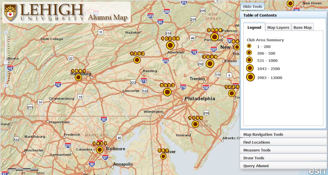
This map uses address matching to display the density and location of Lehigh University Alumni. Due to the sensitive nature of this data, authentication and campus VPN are required.
College of Education
WMS came into the project a few weeks after the formation of the team. We redesigned most of the site and built out the functionality almost from scratch. Currently, we manage the project from a...

Memories at Lehigh
Currently under development, this explores the relationship that memory has with place. Using Drupal and OpenLayers the site allows users to share memories about places at Lehigh.
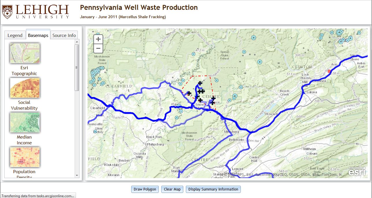
Marcellus Shale Traffic
Used in classrooms to investigate how Marcellus drilling has impacted traffic in rural Pennsylvania. Users select wells and the application estimates truck traffic and routes based on waste...
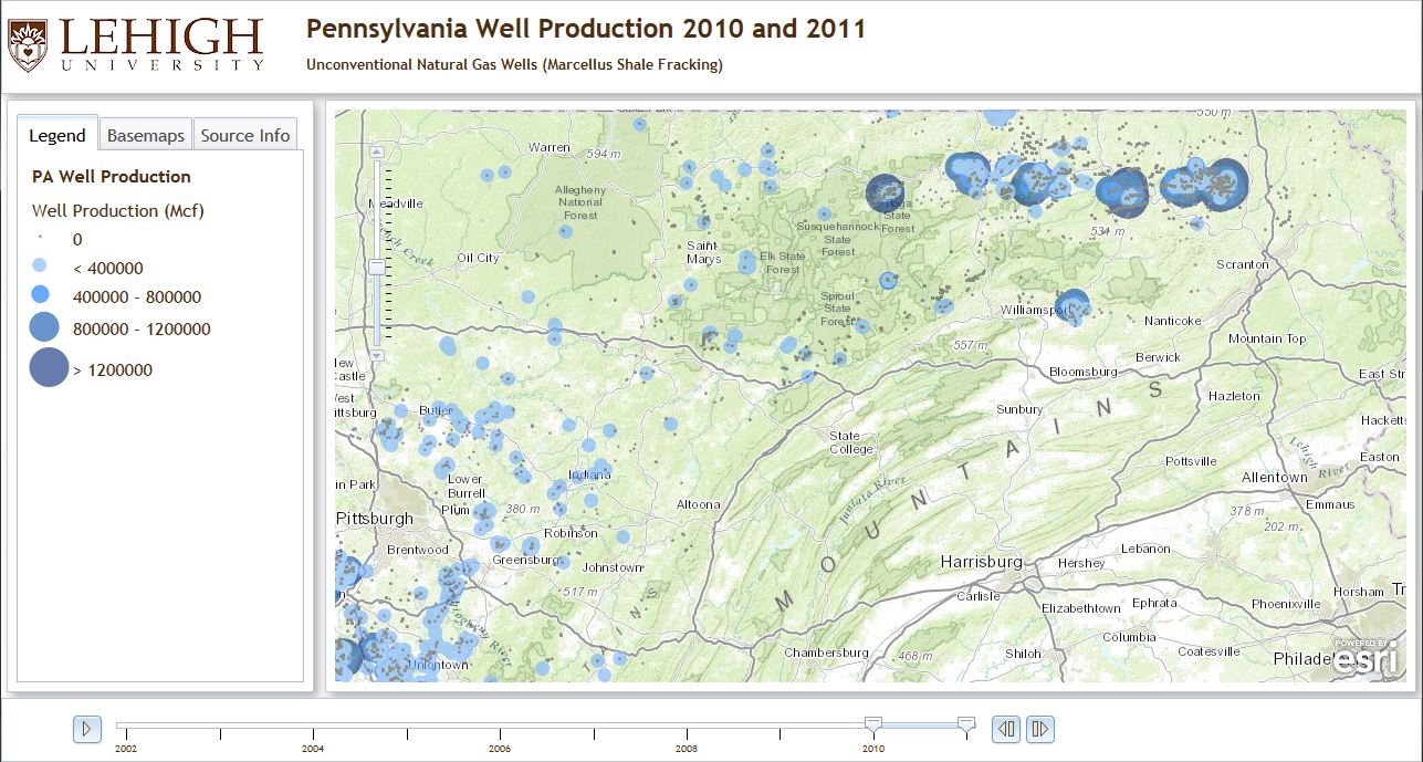
Marcellus Shale Wells
Requested by researchers here at Lehigh, this map illustrates the density and production of unconventional gas wells in Pennsylvania over the past ten years.
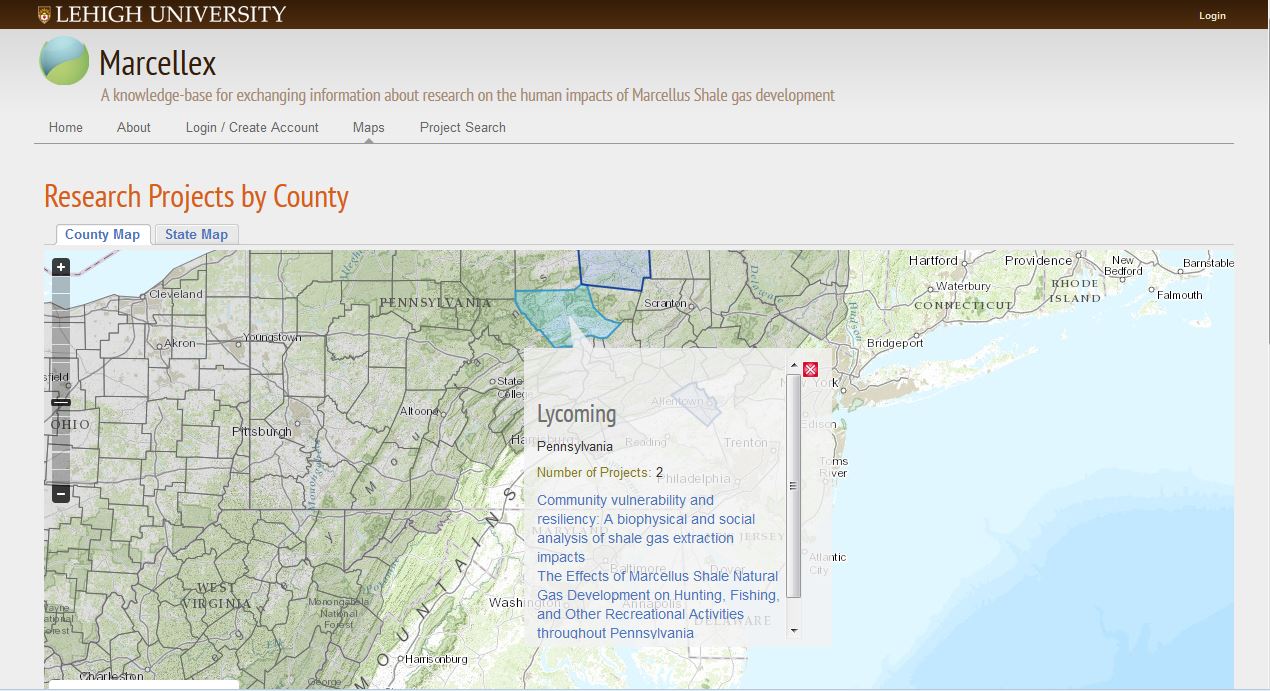
Marcellus Research Exchange
Beta Version. Combines Drupal with open-source GIS to create a spatial repository for researchers to collaborate and exchange ideas as they pertain to ongoing research in shale regions.
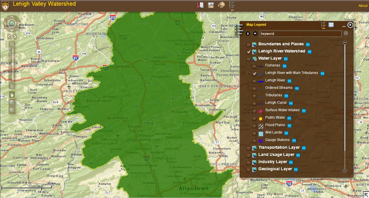
Lehigh Valley Watershed
Used in the undergraduate classroom to investigate the spatial relationships for several local environmental data sets. Layers include watersheds and water quality data.
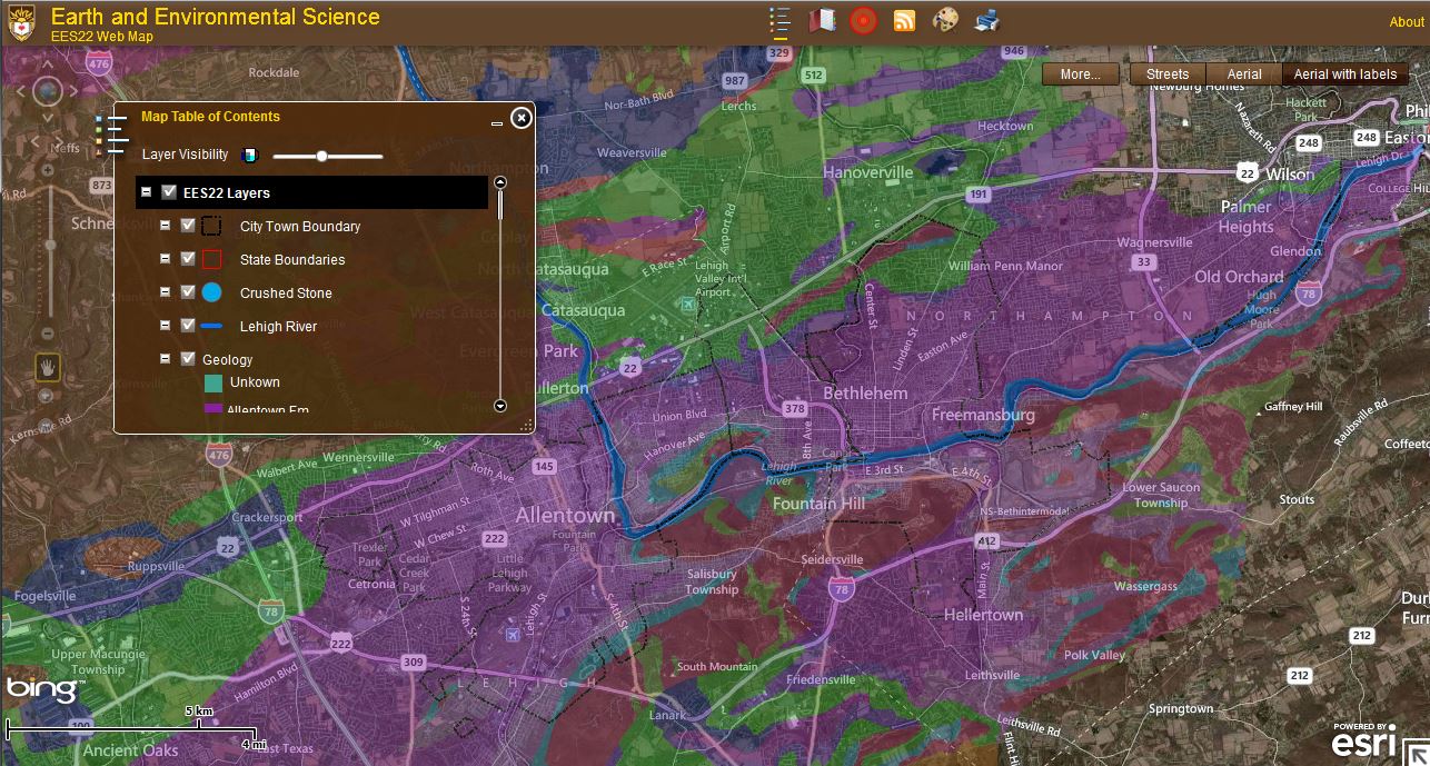
Environmental Science
Used in the undergraduate classroom to expose students to some of the key concepts of GIS and investigate the spatial relationships for several environmental data sets.
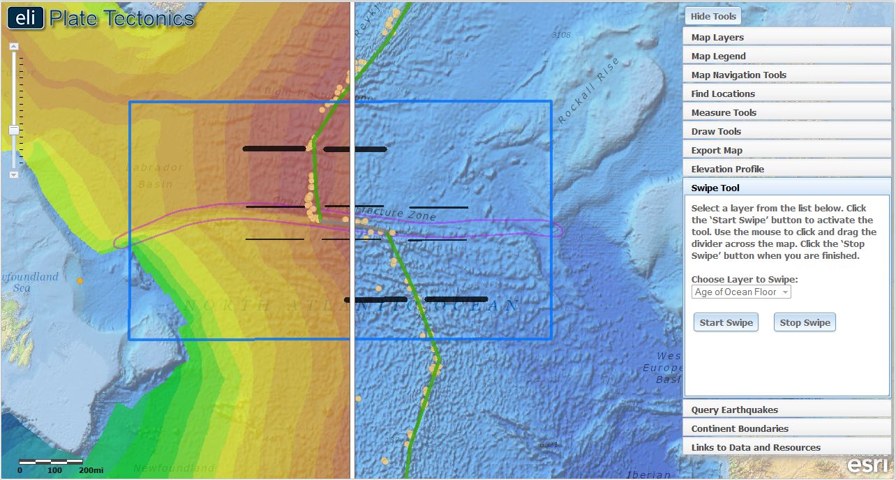
ELI Tectonics, Transform Boundaries
Used for research (Bodzin et al.) to investigate the use of web GIS in middle school classrooms. Students explore the questions like: What happens when plates move sideways past each other?